The following GIS maps overlay the Asian Indian population in the Houston area on the white and black populations, respectively, in select years. The maps are based on decadal US census data.
Several additional maps and a full discussion of the maps are available in Redefining the Immigrant South.
Click on any map to view full-size PDF and open in new window.
Asian Indian over White Population
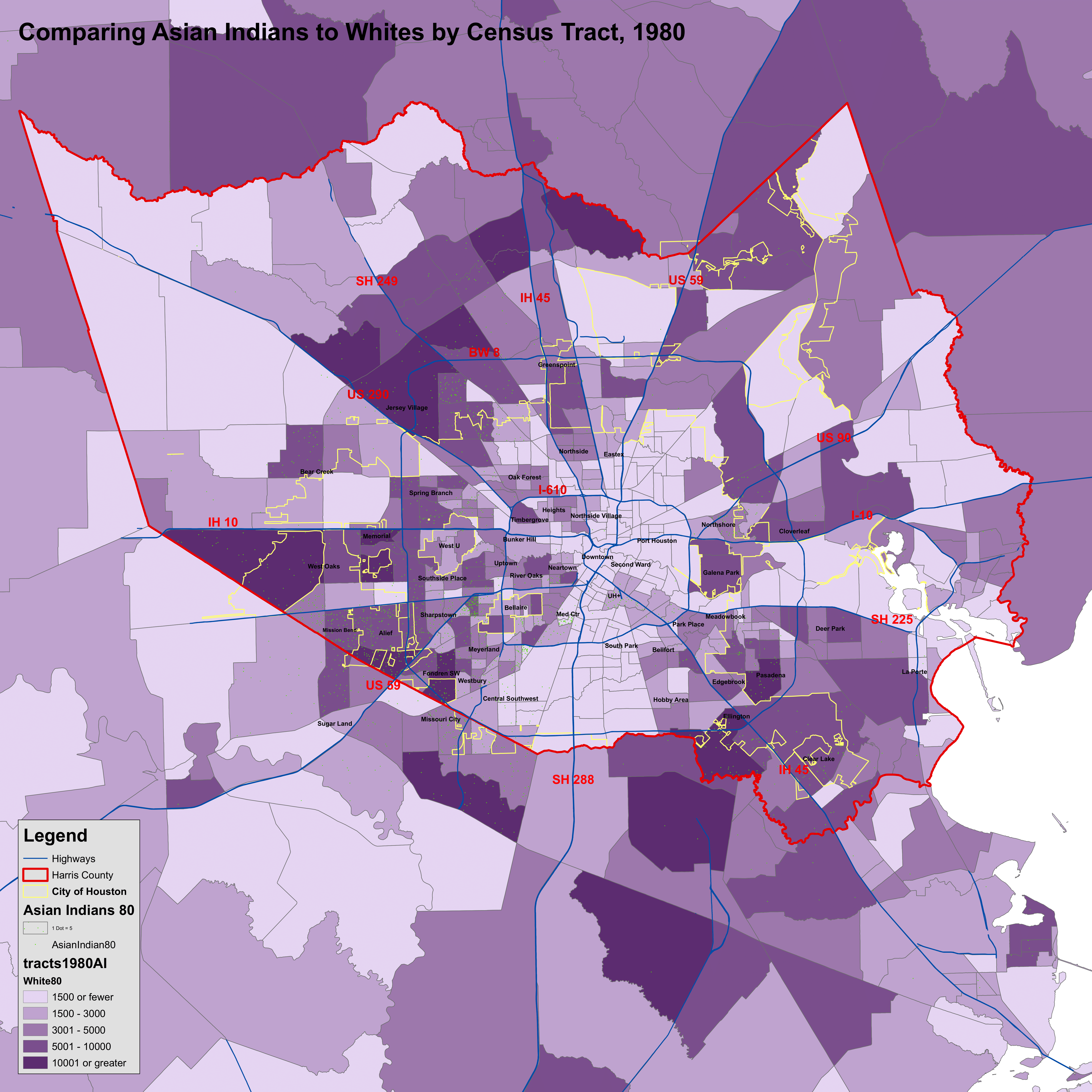
1980
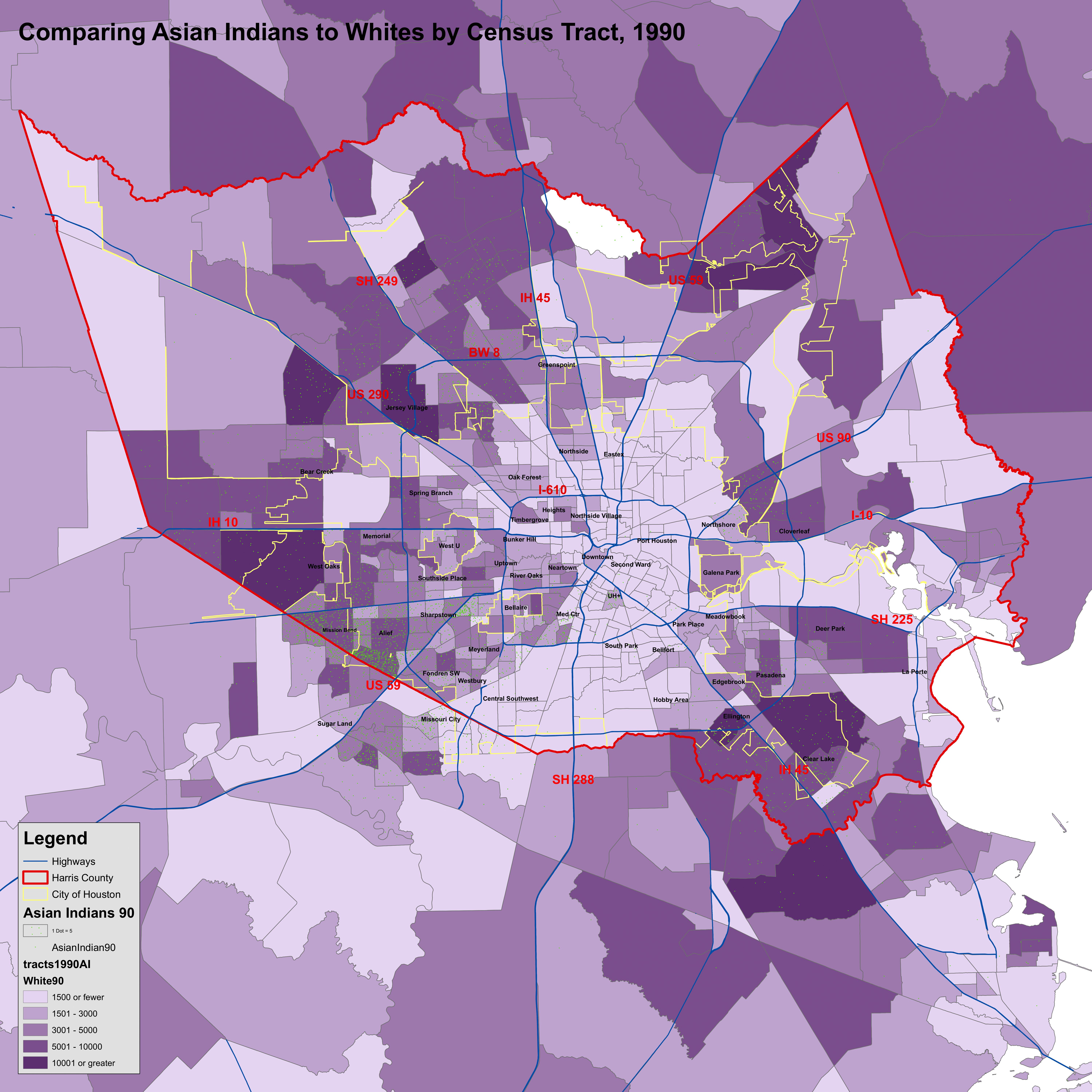
1990
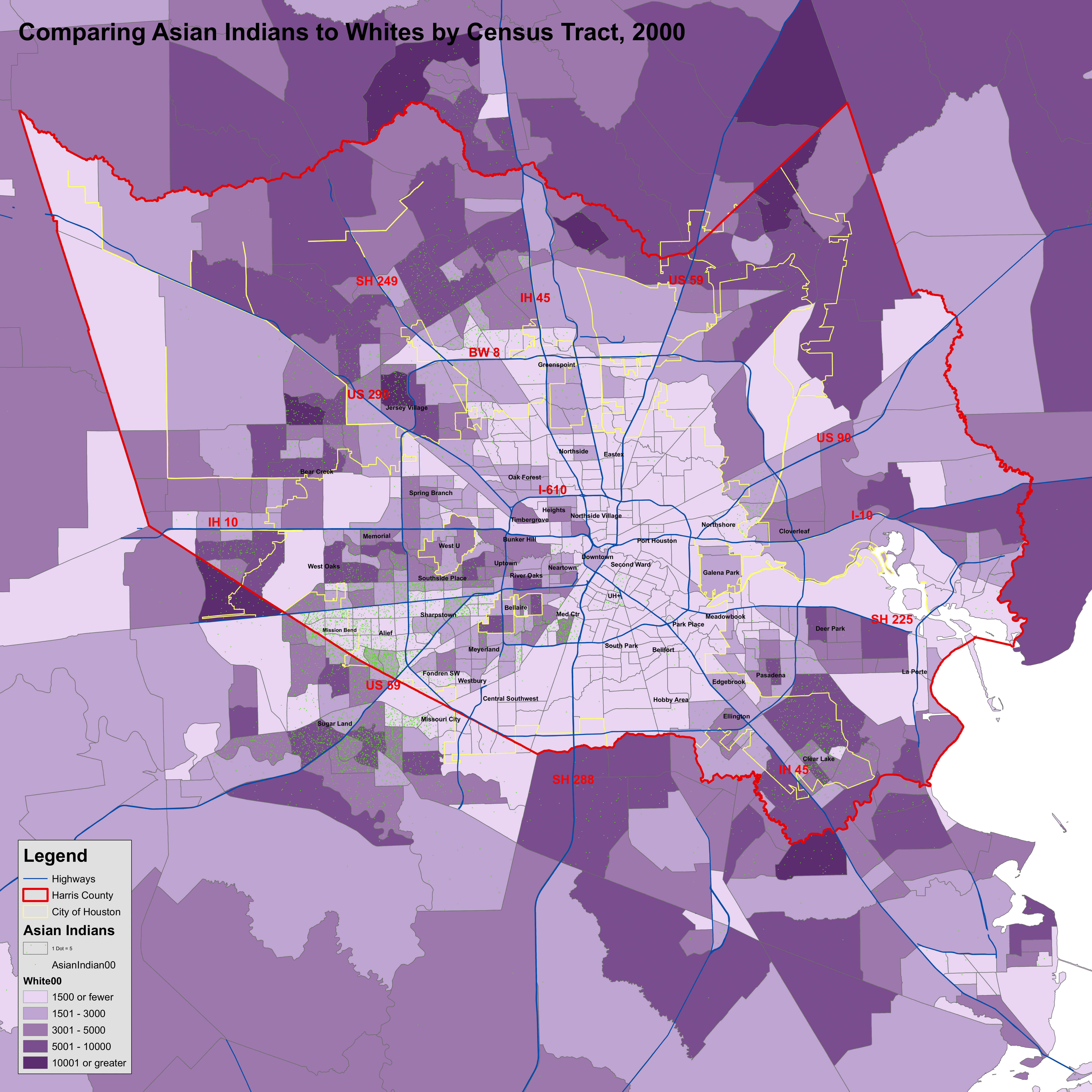
2000
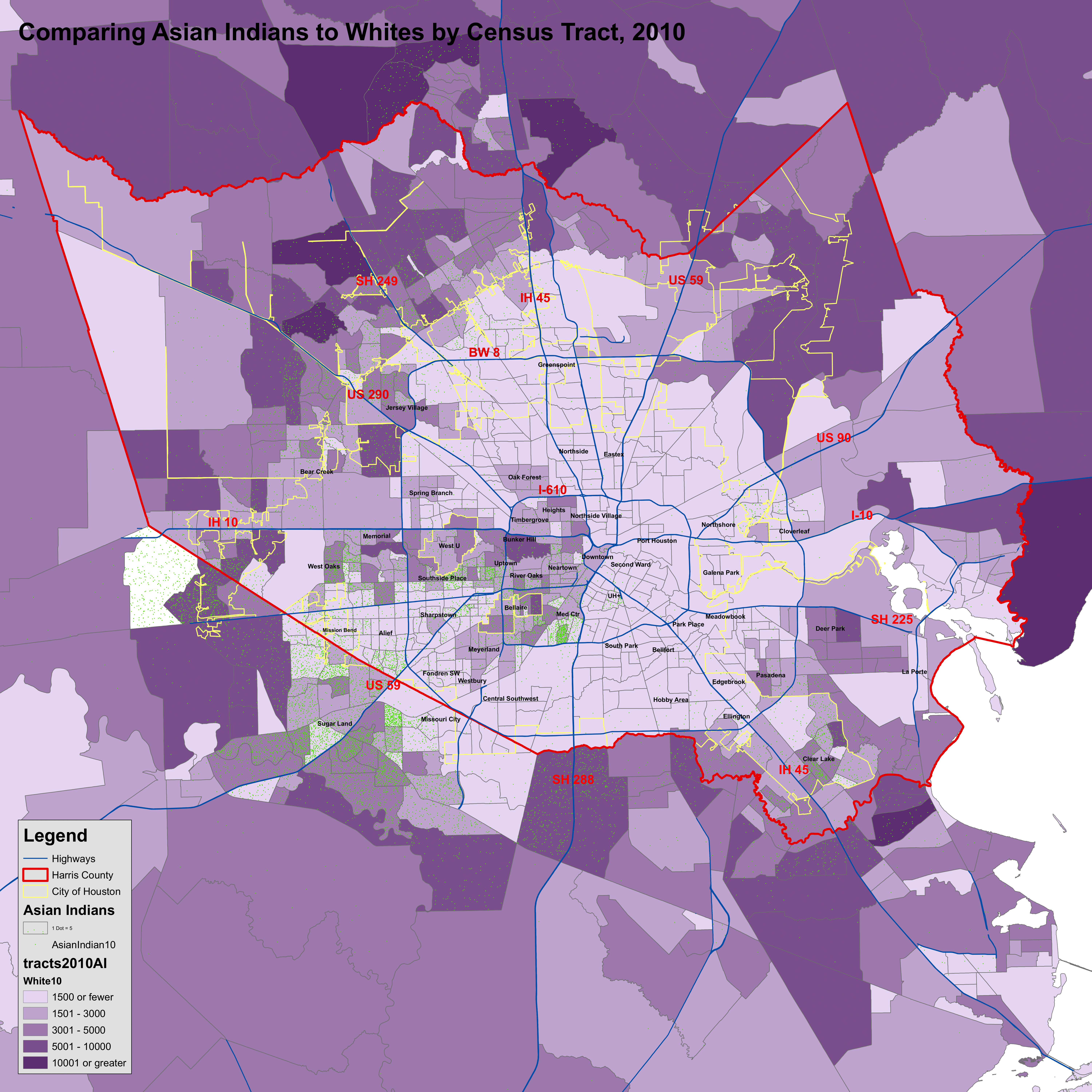
2010
Asian Indian over Black Population
1980
2000
1980
1990
2000
2010
1980